Pyrenees 2012 trip report.
We had a week free in June, so a plan was hatched to include the weekends at both ends, and make a 9 day trip to the Pyrenees. I had a good number of routes that I wanted to try, plus a suggestion from my good friend Alex to also include a visit to the Bardenas Reales national park as well. So we had plenty of material to keep us busy!
I took this opportunity to invite along a couple of friends that had expressed interest in travelling with me in the past. One of my friends was able to join us, so we had two up in a ‘02 reg Nissan Patrol for company.
The loose itinerary was to head for a campsite at Olite in Northern Spain for two nights to give us time to visit the national park before returning north and following tracks on the Spanish side of the Pyrenees in the direction of Andorra, with the aim to make it into Andorra via a smugglers route.
We left early on the Saturday morning needing to make the Euro tunnel at Folkstone by 06:50. Unfortunately part way down the M20 Toyotas legendary reliability let me down, the speedo gave up the ghost and dropped to its stop, perfect! So I had to rely on the Garmin and Ipad with memory map app to give me an indication of my speed.
We crossed into France and were on the road at 09:00. Taking the A16 heading for Rouen, and down the Atlantic route through France. That night we made Pons, just south of Saintes, and camped in a very nice camping municipal.
The next morning we carried on heading south towards Pamplona, and crossed the Pyrenees at Bayonne. Passing Pamplona we headed for the campsite at Olite. (
http://translate.google.co.uk/translate ... CFgQ7gEwAA).
We made Olite by 16:00 on the Sunday, but the wet weather that we had endured all the way down the atlantic coast decided to start up again. Steph and I decided to make for the national park, as it wasn’t far away, whilst our friends retired to the bar to make friends with the locals.
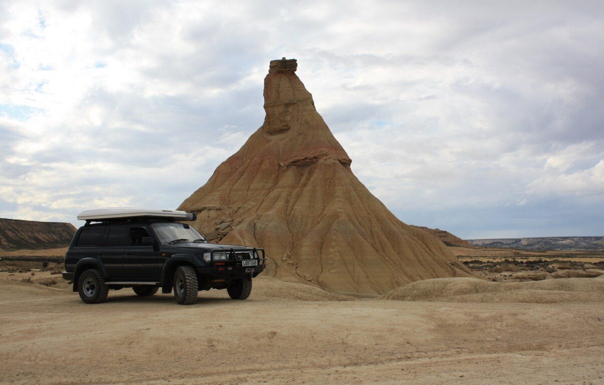
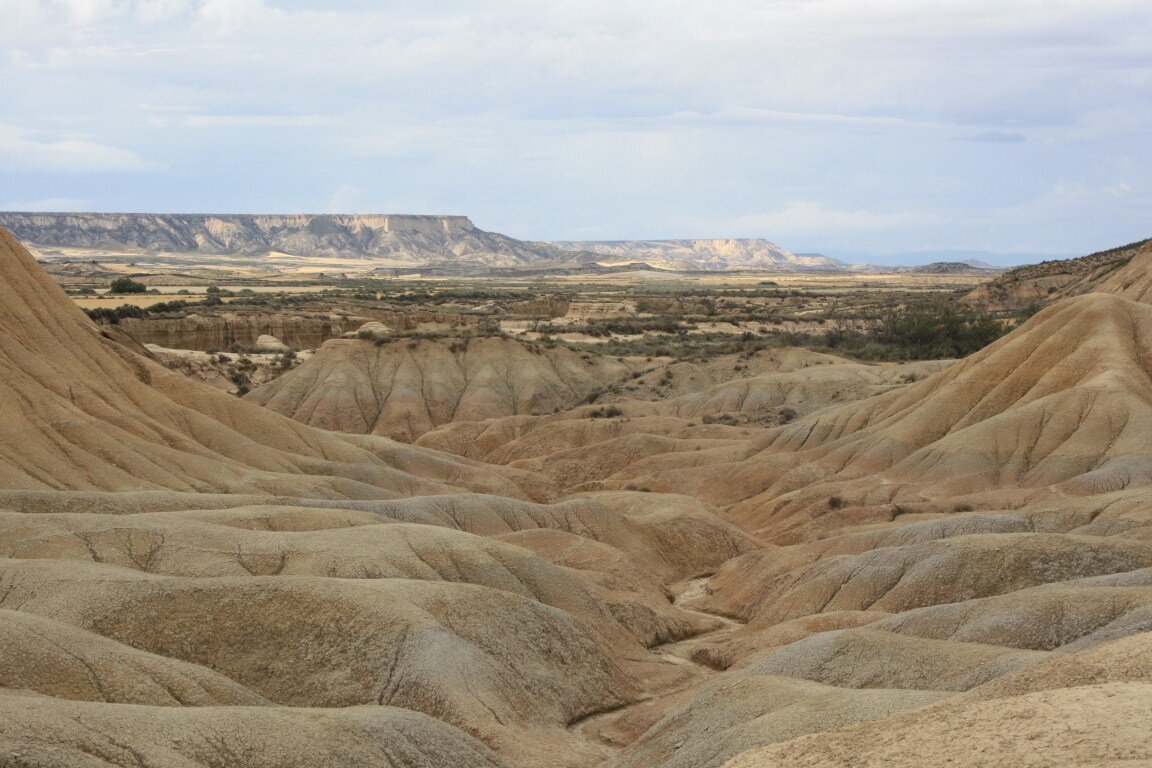
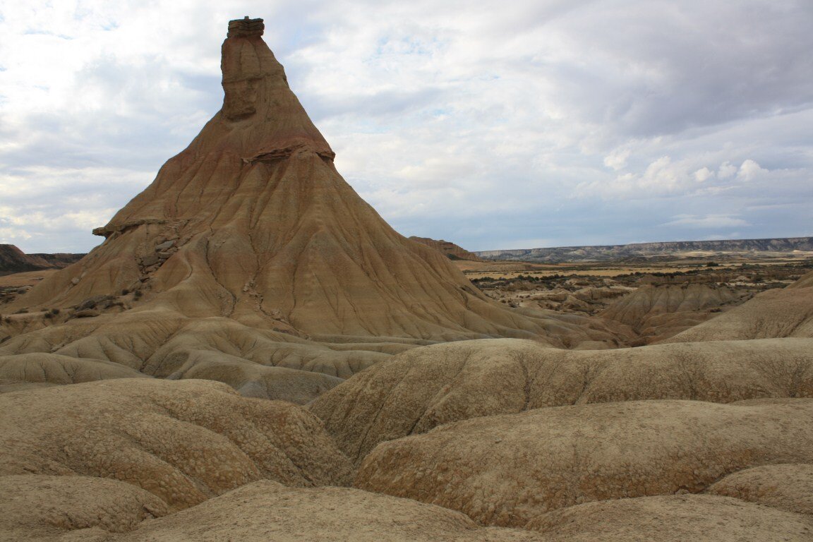
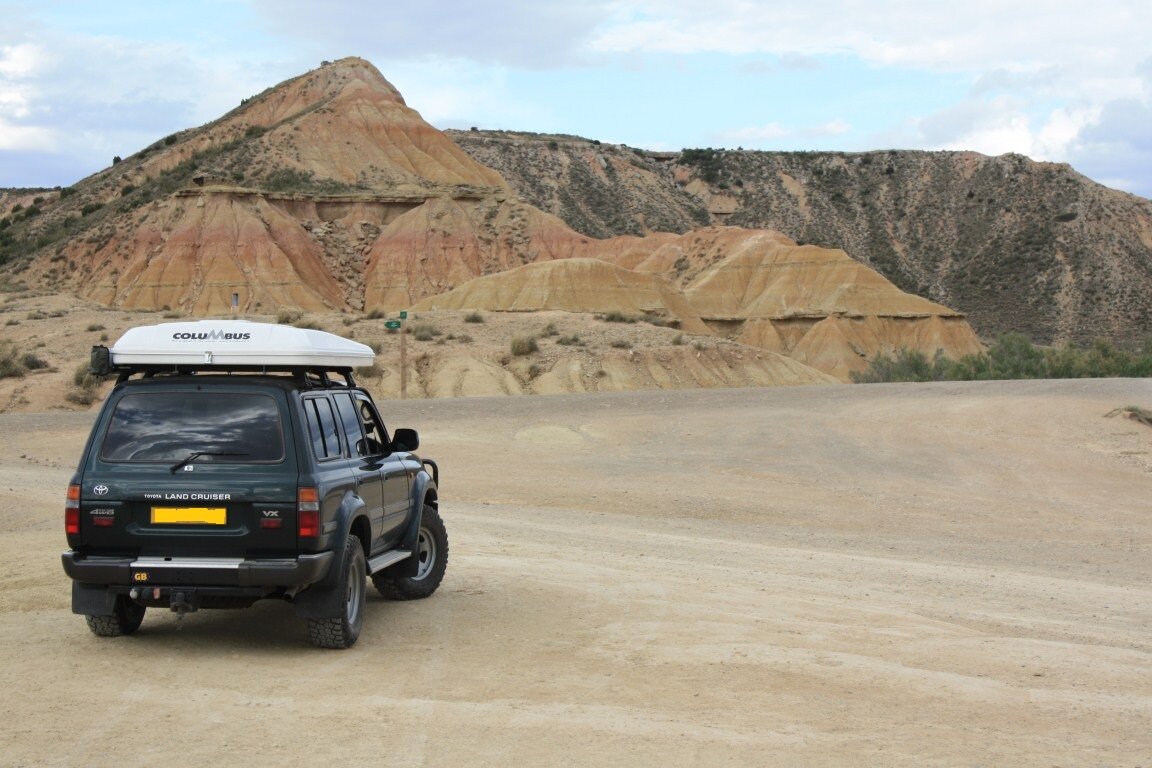
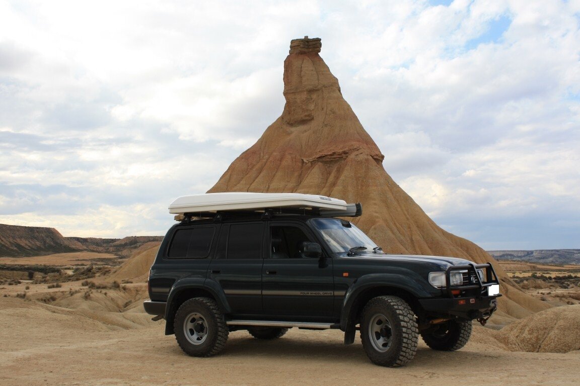
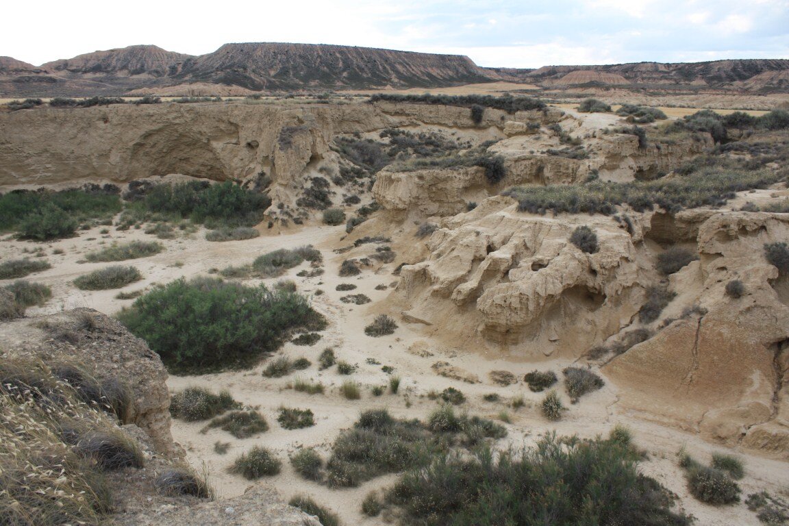
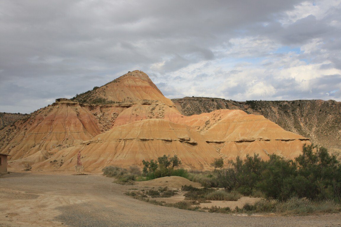
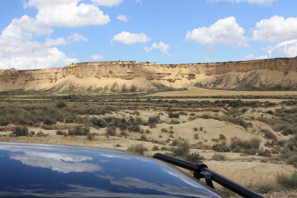
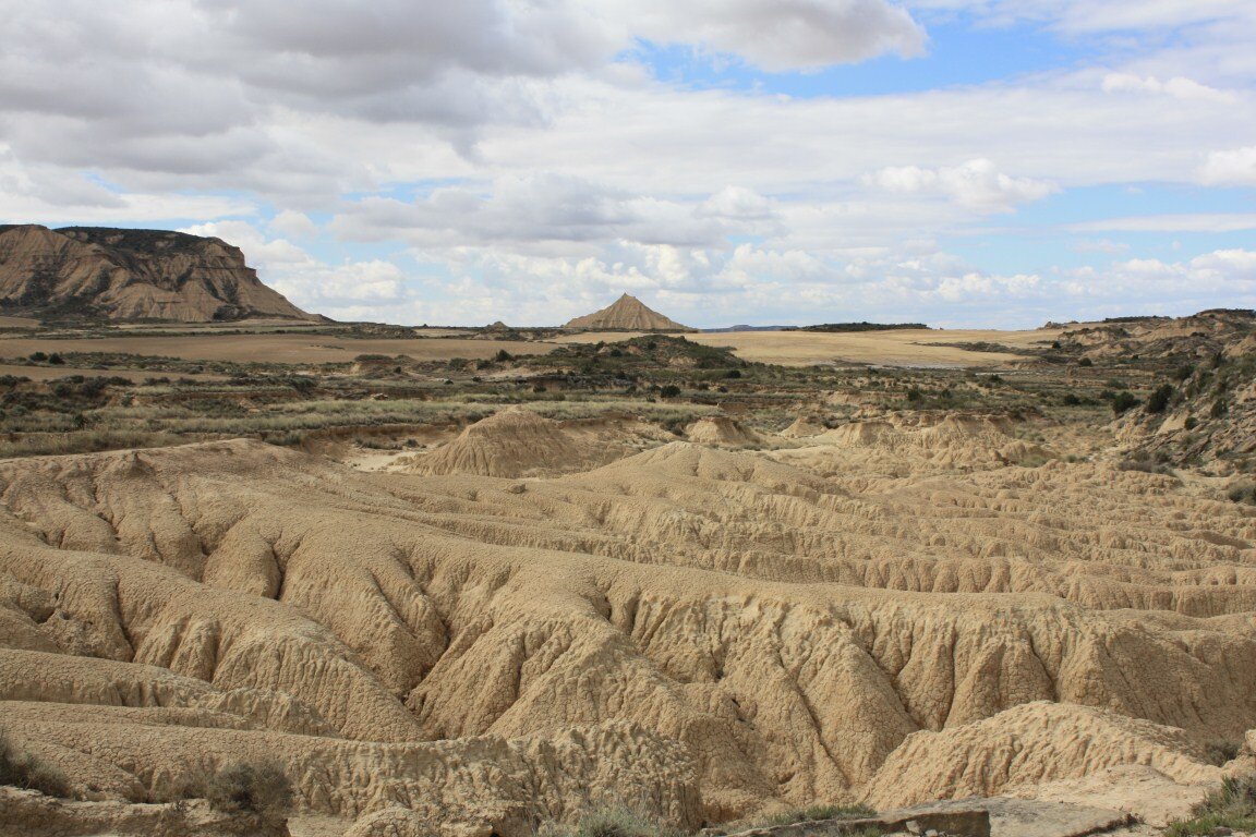
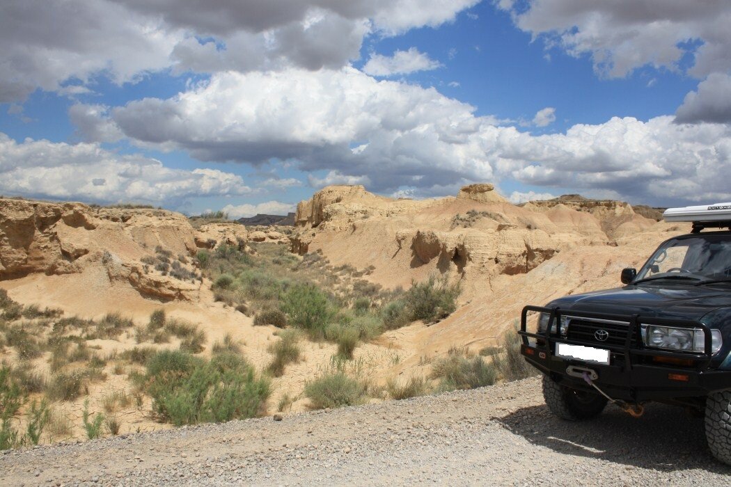
The Bardenas Reales visitors centre is open till 19:00 on Sunday’s; we arrived at 18:40 after having a little difficulty finding the entrance road due to a recently constructed new road. We were pleasantly surprised to see that it was still open, and picked up an English version of their park map. The park map illustrates the routes that you can drive in your 4x4, and gives you an idea of where everything is located. Top marks to them for being so organised, and allowing access to such an amazing landscape.
As it was now the evening we pretty much had the national park to ourselves which was amazing. We drove round to the Cabezo de Castildetierra, followed by the northern edge of the inner loop, before back tracking and heading for the campsite and a well earned rest. Upon our return our friends informed us that the locals hadn’t seen weather like this, at this time of the year, in over 50 years!
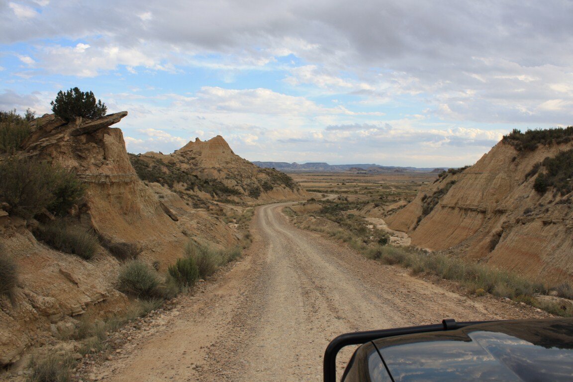
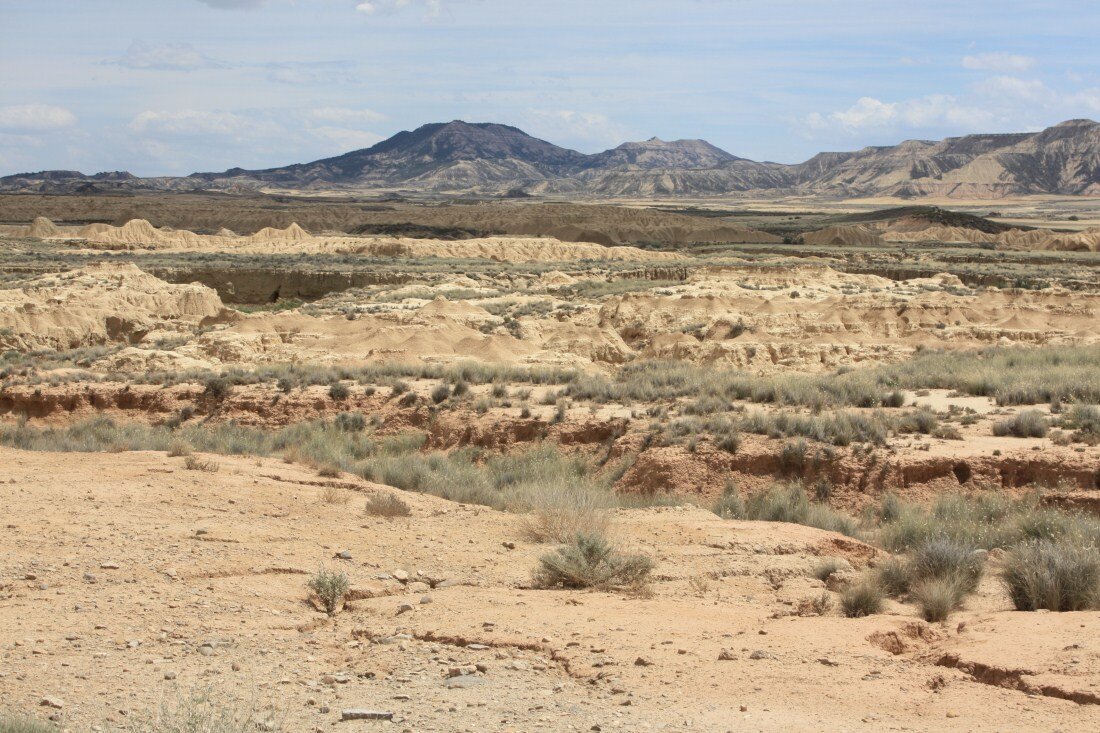
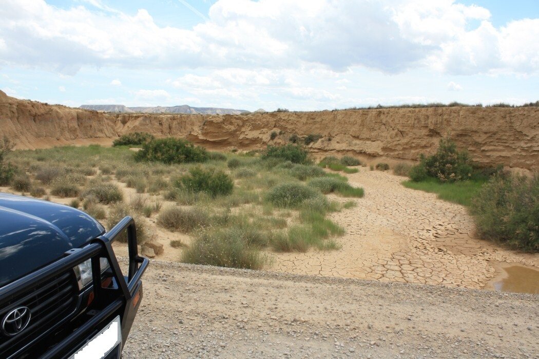
Monday morning, its not raining and we’re all off to the Bardenas Reales. We decided to enter the park by a track that branches off the N-121 a little south of Caparroso and head down to Arguedas. We then head past the visitors centre and did the main loop in the centre of the park, before heading round via road to the Portimayor track. This track ended at Fustinana, so we then used the NA-126 to pick up the Pena del Fraile track.
The final track of the day saw us cross out of the Navarra region and into Zaragoza, to pick up a long track that followed a high ridgeline along the parks southeastern edge.
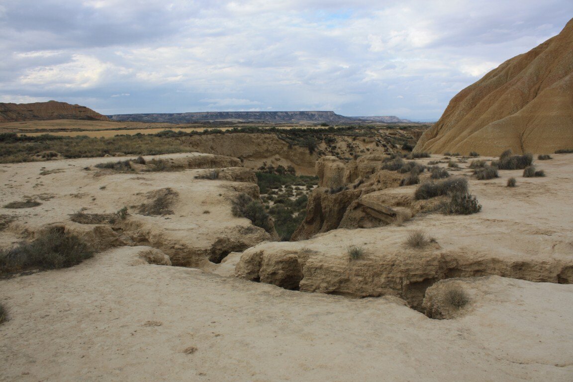
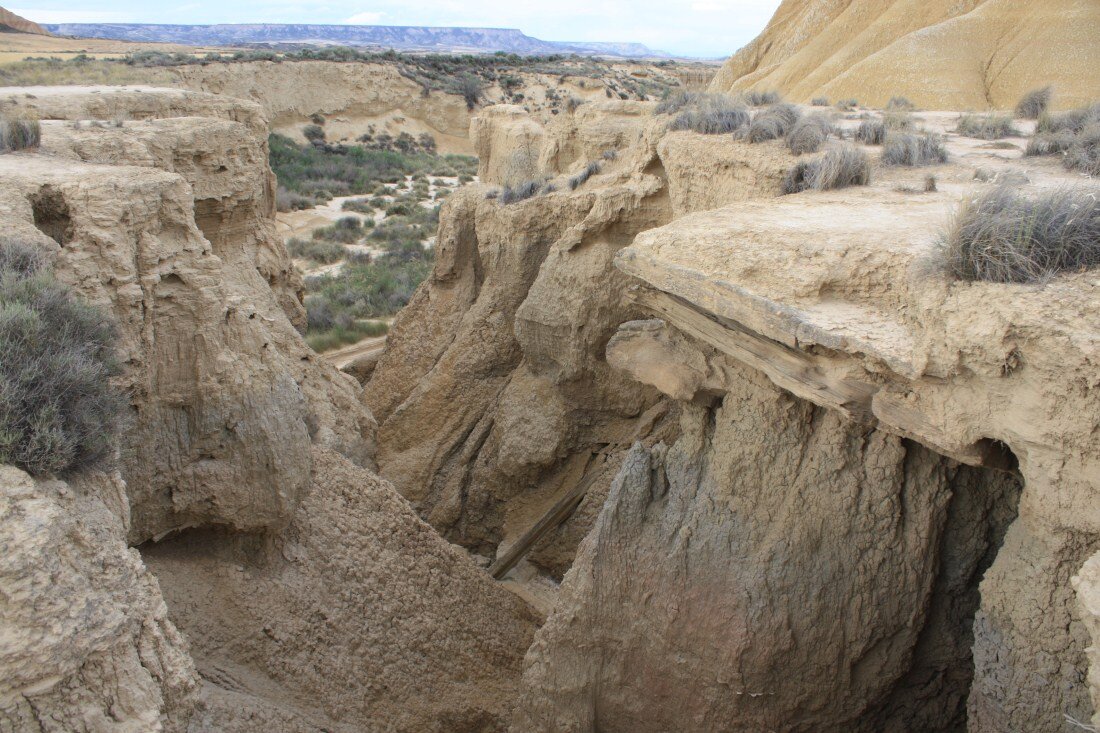
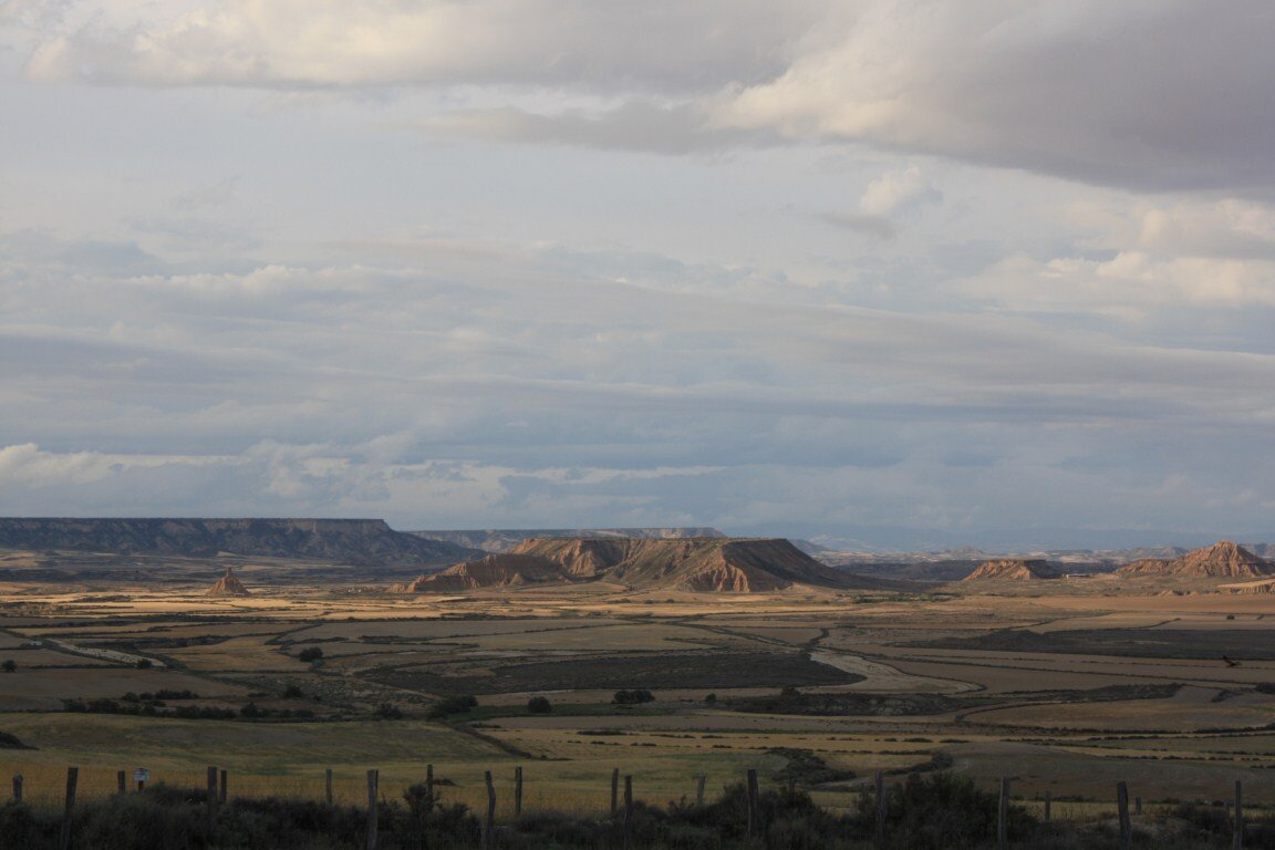
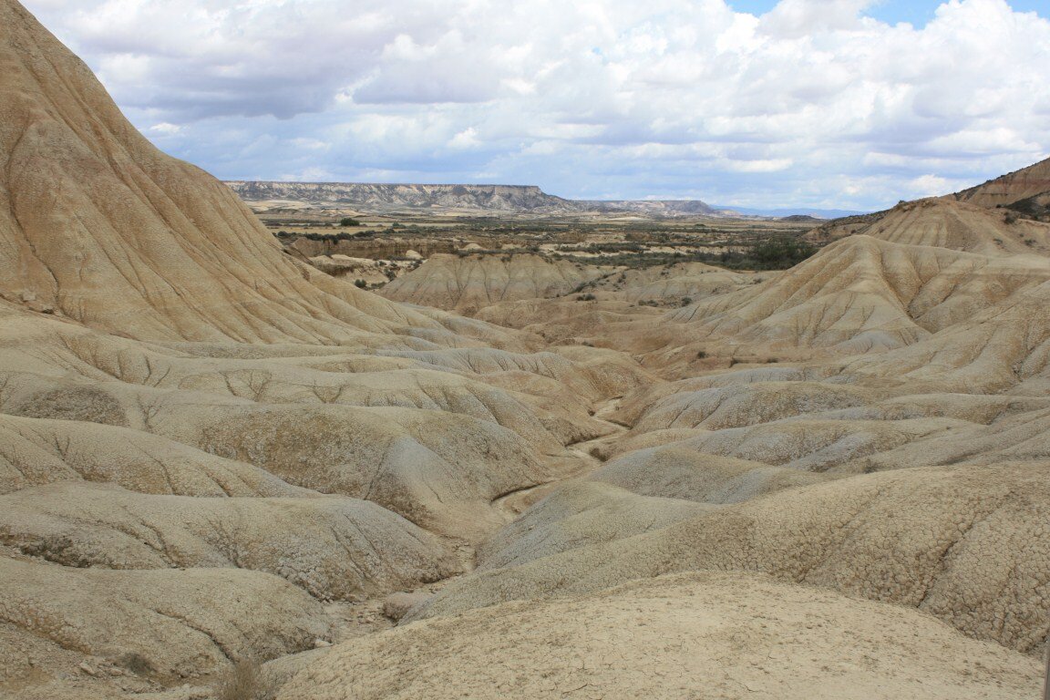
Tuesday saw us return to the Bardenas Reales central loop to take our final track heading north out of the national park, via El Paso. Our time spent at the Bardenas Reales was brilliant, the scenery is stunning and photographers would love it.
Next was a road move east to towards Graus to pick up routes on the Spanish side of the Pyrenees. Approaching Graus from the south on the N123a, the road was particularly scenic; we passed through town and stayed in campsite located just out the other side. Our camp spot at camping Fuentes de regrustan (
http://www.campingregrustan.com/), was situated next to a river and the temperature was in the low 30’s, so everybody was busy sun worshipping!
On Wednesday we paid a visit to an 11th century fortress ‘El Castillo De Fantova’, it was a great structure, offering commanding views of the surrounding countryside. There were information boards telling the history of the fortress, and the Spanish are very trusting as they leave everything except the church open for people to see. If you do climb the main tower you are rewarded with not only the views, but a little surprise as well.
We drove a few tracks in the area, which gave great views and passed through a few deserted/derelict villages. Our lunch stop was a nice spot next to a river, before pressing onto our final track of the day El Turbon.
El Turbon is a dead end track that climbs 900m up to a refuge at 2000m above sea level, in a short space of track. So it’s a steep slow hairpin crawl to the top, over a few rock falls on the track. This was a typical Pyrenean mountain climb and very rewarding once you reached the top. The vehicular right of way ends at the refuge, but the summit is another 492m up and is accessible on foot. The views are stunning, the refuge has real character and the rock formations are intriguing.
Note how recent the signposts are, and the holes in the brick pillars outside the refuge, do you think this has anything to do with the fireplace inside the refuge?
Thursday we set off after a second night at Graus, and picked up the start of a track at Munia. This track starts off at a picturesque picnic spot with a bbq area, tables and benches surrounded by a couple of streams. The track led through a wooded area for the first section, the tree covering meant that there were some puddles left from the recent rain, which meant that the mud tyres might earn their keep! As it was, there wasn’t anything to worry the Land Cruiser, but there was a deep enough bit to give the underside a good coating.
This track was tricky to follow at times, as there were a few junctions along the way, some leading off to villages, and others heading off into the unknown. As we progressed we emerged from the woods into a valley, the track was narrow with a drop off to the right and a steep bank to the left, yes you’ve guessed it, we met a farmer in his tractor. I think he was stunned to see another vehicle on the route, let alone a foreign one!
Fortunately there was a gap in the bushes to my left so I pointed the 80 up the bank and trickled on the power, under foot there was deep grass and moss covering the ground, filling the gaps between the basketball sized rocks, but the 80 continued to walk up and over the rocks no problem. Once I was completely off the track the 80 was now very nose high, and I felt that the front wheels might start to break traction, so I stopped and switched on all three lockers and trickled the power back on, she didn’t slip at all and you felt the real difference, and confidence that lockers give when in tricky situations. By now there was enough room for the Patrol to pull in behind, and the farmer passed by and carried on his merry way, as did we (once we’d backed out and rejoined the track!).
After losing the track near Gabas, we followed another track that was sign posted to a church up high in the mountains, as we needed a good spot to stop for lunch and hopefully we would be able to see our track from there.
This lunch spot turned out to be a very small chapel ‘Ermita De Sin Chuan’, a perfect vantage point for working out the route of our intended track, and to enjoy the layout of the valley opening out before us. So after lunch we followed the track back down and rejoined the track that headed in the direction we wanted to go.
This section of the track wound left and right with lots of hairpins as it followed the mountainside round and along the valley. To start with I could see evidence of vehicular use, but the track had started to get over grown and I had to stop and do a little pruning to some branches that had dropped across the track. By now it was mid afternoon and it was hot, but due to the undergrowth we couldn’t have the windows open much, so we opened the sunroof and made do with that.
Continuing along we found ourselves pushing the vehicles through the undergrowth (which isn’t my most favourite past time), and then I lost the tyre tracks, now there were only mountain bike tracks leading down the centre. At times it would get quite over grown with branches trying to join us through the sunroof, then it would ease and you’d think that you were through the worst of it, only for it close in again.
We had a chat with our friends in the Patrol and decided to press on, as we didn’t fancy pushing back through what we’d already driven, plus there was the promise of a challenging section somewhere along this bit of the route (maybe we were already in the challenging bit!!). We continued on, and after half an hour (it felt longer) we emerged from the undergrowth, with branches, leaves and bugs all over the LC and Patrol, plus one of the Patrols mud flaps was close to parting company with the vehicle due to contact with the scenery. We stopped and inspected the vehicles, I don’t think that the paint will ever be the same again, but we were through.
By now it was very hot, and with no shade around at this point on the track, we didn’t hang around long and pressed on. The track was now descending down the valley, and round one bend appeared the challenging section. There were thick rock slabs forming the basis of the track and they were sticking out at an angle, fortunately causing the vehicle to lean towards the mountainside and not the drop! This made a nice little section to remind your brain what side slopes feel like. For us the rock was dry and the tyres were sticky, but if it was cold and raining I bet it would be a bit interesting.
After all that excitement/torture we made a road move along to our next area of interest, near Vielha. We picked a nice campsite on the N-230 near Pont D’Arros, again next to a river, the sound of which drowned out the noise of any passing vehicles on the road on the other side. The campsite was called Camping Verneda Vall D’Aran (
http://www.campingverneda.com/en/camping.php).
On Friday morning we left the campsite and skipped a track almost on its doorstep, as I drove that last year, and headed to Baqueria to climb up into the mountains and pick up the track.
At first the track is wide and passes high up between the peaks, before it enters into the wooded mountainside and narrows. This section follows the river as it makes its way between the mountains, with a few small waterfalls careering down the mountainside and passing across the track to continue on their way to the river below. We met a few vehicles on this section of the track, plus a few cows that weren’t too keen on letting us pass. As the narrow section ends, the track crosses into a national park and the route widens again as it passes through rolling lush meadows with trees skirting them and continuing up the mountain sides. Soon the track rejoined the river and followed it as we descended further to the tracks end.


From the end of the last track it was but a stones through across the other side of Esterri D’Aneu to the climb up to the next. This was a dead end track that climbed up to a waterfall; the route was very narrow for pretty much the whole ascent, and on one particular hairpin instead of being out in the open, you found yourself easing between tall rock faces, most unusual. Further up a small bridge allowed the track to pass over the water cascading down beneath, before leading up to a clearing and stunning views of the peaks surrounding us and the valley which we’d just driven up. This made the perfect lunch spot, with the 80 providing shade, as it was glorious weather and easy to get over exposed being at altitude.
After lunch we descended back down the track before doing a short road hop round to pick up a smugglers track lead into Andorra. The route starts deep down in a tight gorge, before starting to climb all the way to the summit in Andorra.
As we got higher up in the mountains, the track got quite rough and rutted, the mud had formed into ruts all over the track and now set, making picking a smooth line tricky. There were also lots of fallen dead trees stacked up in what would have been the melt water courses during the winter, couple this with the rocks and spoil all over the place and its clear to see that this area had suffered a rough/harsh winter.
On one of the hairpins we met an English couple on Belgian registered motorbikes, they asked to double check their current position, and how far they had to go, as the track was so rough that they may turn back. So we had a chat, about how well they’d done to make it this far, and that they were two thirds of the way up the ascent, so should carry on. They agreed and said that they’d follow on behind us, although the guy did said he was very envious of the LC and Patrol at this point. (The female rider had only been riding a year and already had Morocco under her belt. Good going in my book.)
Further up the track I also notice evidence of recent repairs to the drainage trench running along side, and it wasn’t long before we found the repair crew, who had rocks and soil blocking the track. There were two guys, two dogs, a JCB and a 70 series pick up. Upon seeing us they stopped work and used the JCB to push all the rocks and soil over the edge and rolling down the mountainside to clear the path for us, I lost count of the number of times the JCB’s front wheel dropped over the edge! Top guys for letting us through so quickly.
Not long after we passed the repair crew, we reached the summit and the tarmac decent that leads down into Andorra. The view of the peaks at the summit is impressive, so we paused here and let the vehicles rest for a minute before starting the 18km decent.
That night we camped at Xixrella, next to a river again, (bit of a theme going on here!) (
http://www.xixerellapark.com/camping/es/index.aspx), it’s a nice campsite surrounded by mountain peaks on all sides. As this was our last night in the mountains we treated ourselves to a meal in the restaurant, to celebrate our trip.
Saturday morning consisted of picking up some duty free shopping, and fuel (1.16 euros per litre, cheapest of the trip!), before heading out via Andorra’s northern border crossing with France. Fortunately we were heading the correct way, as the traffic was extremely busy entering Andorra with people flocking in to buy cheaper goods.
A word of warning for driving in Andorra, there are speed cameras hidden all over the place, and police standing in the road in most towns, so caution is needed. What a joy it was to navigate without a speedo!
We then headed up the centre of France, on route to Calais. That night we stayed at lovely little camping municipal in Vatan. It’s a perfect stop over campsite, a stones throw from the auto route, and the little town has a good selection of shops. We couldn’t find the manager, but an English couple at reception said to pitch and he’d show up later, so off we went and made camp.
Later I bumped into the couple again and they commented on how good the 80 looked, and how quickly it was pitched! It turned out that they were three weeks into a three month trip to ride bicycles to Turkey! Fair play to them. They did ask what the weather was like on our way up, as they hadn’t seen a dry day yet. That evening it started to rain just as they started to cook dinner, I offered them shelter under the foxwing, but they were so knackered I think they just went to bed. (The foxwing was brilliant, and earned its money on the trip).
Sunday was a late start as we treated ourselves to lie in, and a 10:00 start, after paying just 9 euros for our pitch (very cheap). On the way back up we were passed by lots of fast moving English registered performance cars on the auto route, plus a motor home that had a large picture of James Hunt on the back with two fingers up! It turns out that they were on their way back from the LeMans 2012. Although they were fast, I kept passing them when they had to keep stopping for fuel, only for them to pass us again. Needless to say I saw a load of them again at the Euro tunnel port. A 19:20 train saw us back home before 20:00.
A successful and enjoyable trip for all involved. The 80 took it all in its stride.


Can you camp in/near the park? Thinking of Portugal in September but Spain is worthy of a detour.