Don't like the adverts?  Click here to remove them

Romania 2015

Does anyone interested in this trip have any mapping apps or recommended East European maps supporting GPS for use on an iPad?

I'm crap at IT stuff! I have CoPilot which I paid for but it ends where the asphalt ends :shifty:

I've also got googoo maps which is better for tracks. Is there anything better out there?

I've downloaded an app called cycle maps, which is supposed to trace a route taken, but haven't used it yet. I want to drive some routes and see how (if) they plot for future use.

Cheers :lol:
 
Last edited:
I was looking to try these maps http://www.openstreetmap.org/#map=5/51.500/-0.100

They are open source (free). I haven't seen their Romania maps yet because my navigation PC is out of action at the mo.

I don't know much about Apple products but I think you can use them with this app: https://itunes.apple.com/en/app/openmaps/id359719250

Thanks Reinhard!

I found the app and installed it. It looks good at first glance! I'll have a play with it and see how detailed it is.

Cheers :icon-biggrin:
 
the top link is for iphone and ipad

left of the page it say ipad download

the second is for a windows base phone
 
Last edited:
Don't like the adverts?  Click here to remove them
the top link is for iphone and ipad

left of the page it say ipad download

the second is for a windows base phone

Silly me, a senior moment there ratrace! I'll have a go at installing that. The problem is, most of these maps are internet based, so when you're away from the wifi (such at on top of the mountain) you lose the map.

I've got a data sim in the iPad and I was hoping that would receive a signal to maintain the maps on screen. Maybe I'm thinking backwards again, I'm not good at this IT lark, so I really have no idea what's going on most of the time! :oops:
 
thats y i got the nokia phone, maps are base on the phone and no sim card req to use the maps

downside is the small screen
 
Problem at the moment, App Store says come back later... they must be closed for stock-take or something:lol:

I'll try tomorrow. On open maps, it shows a track all the way from Secaria due north to Busteni. If that's navigable, then it'll be an ace trip! I'll have to try it out first. We're not going to the house this w/e :icon-cry: but next (if the weather permits). :dance:
 
Hi

Two suggestions for off-line maps:

Maps with me - when you download the lite version you can then choose maps by country and download them for offline use. Ive just downloaded Portugal. It uses Openstreet as well.

Arctic Quest - but you need the paid for version - it allows you to download maps in sections ('tiles') for offline use (Important though - as I found in Portugal - if you download Lite version first, you must uninstall it when you upgrade, otherwise it defaults to Lite functions, hence I couldnt download for offline use.) Good thing is you can download google earth maps, rather than road type maps, handy when the tracks arent on a roadmap.

Pete
 
this might be good for u
click overview on the left and u get this

Onboard Maps
Downloading and storing maps for offline access is faster and easier than ever.
MotionX maps can be cached for offline access and lightning fast rendering!
MotionX Terrain and Road maps and NOAA marine charts can be stored for worldwide use and no data fees.
 
Hi

Two suggestions for off-line maps:

Maps with me - when you download the lite version you can then choose maps by country and download them for offline use. Ive just downloaded Portugal. It uses Openstreet as well.

Arctic Quest - but you need the paid for version - it allows you to download maps in sections ('tiles') for offline use (Important though - as I found in Portugal - if you download Lite version first, you must uninstall it when you upgrade, otherwise it defaults to Lite functions, hence I couldnt download for offline use.) Good thing is you can download google earth maps, rather than road type maps, handy when the tracks arent on a roadmap.

Pete

Cheers Pete!

I'm getting quite a collection now, should be able make something of this lot! :lol:
 
I know I said I can go at any time, but I think I would like to avoid this season, is it always like this Clive?

http://www.youtube.com/watch?v=wmRYCQgzwpE

I have to say no Chas, but it varies quite a lot. Put it this way, I've never been beaten getting to the house. Winter 2012 I had just under a meter though, digging the gates out to make a parking platform did my back in!

The local authority are quite good at clearing the snow. The problem I have with my lane is ice. Temps can go down to -20C and there's always water running down the track, so it builds up to 10" thick solid ice in places. There are not many tyres that will cope with that on a steep hill.

There are a few mountain national and county roads that they abandon in the winter. Locals dig them sometimes, but generally they just have a road closed sign up December through April.

You'll be fine Chas, don't worry. I have chains and a good strop! :lol:

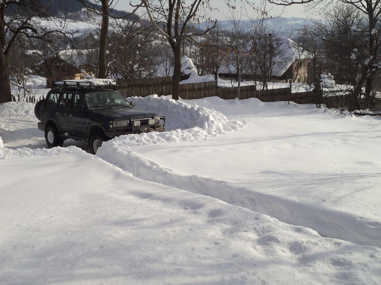
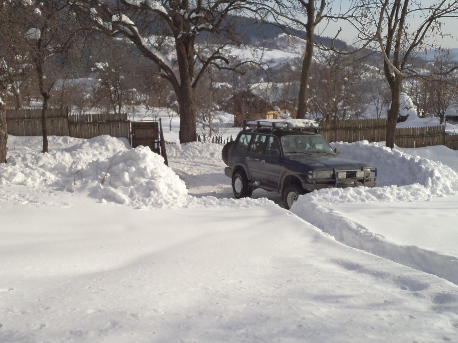
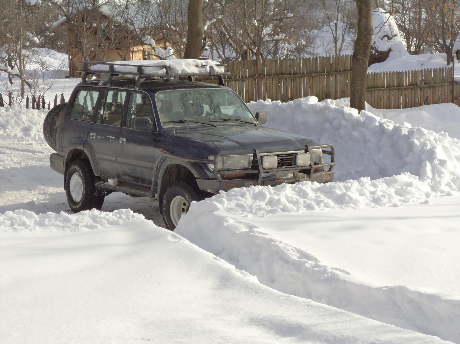
Thought some pics might be needed, this was the deepest we've had at the house, which did my back in!

DSC00509.jpg

You can see the height of the pile shifted!
DSC00510.jpg

DSC00511.jpg

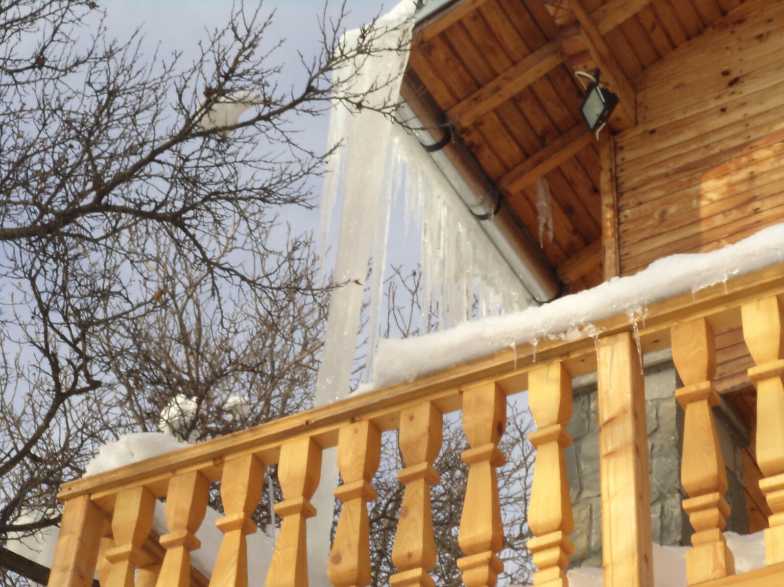
And I had a bit of a leak from the guttering when it was rather cold, melt of the roof had to go somewhere...

DSC00512.jpg

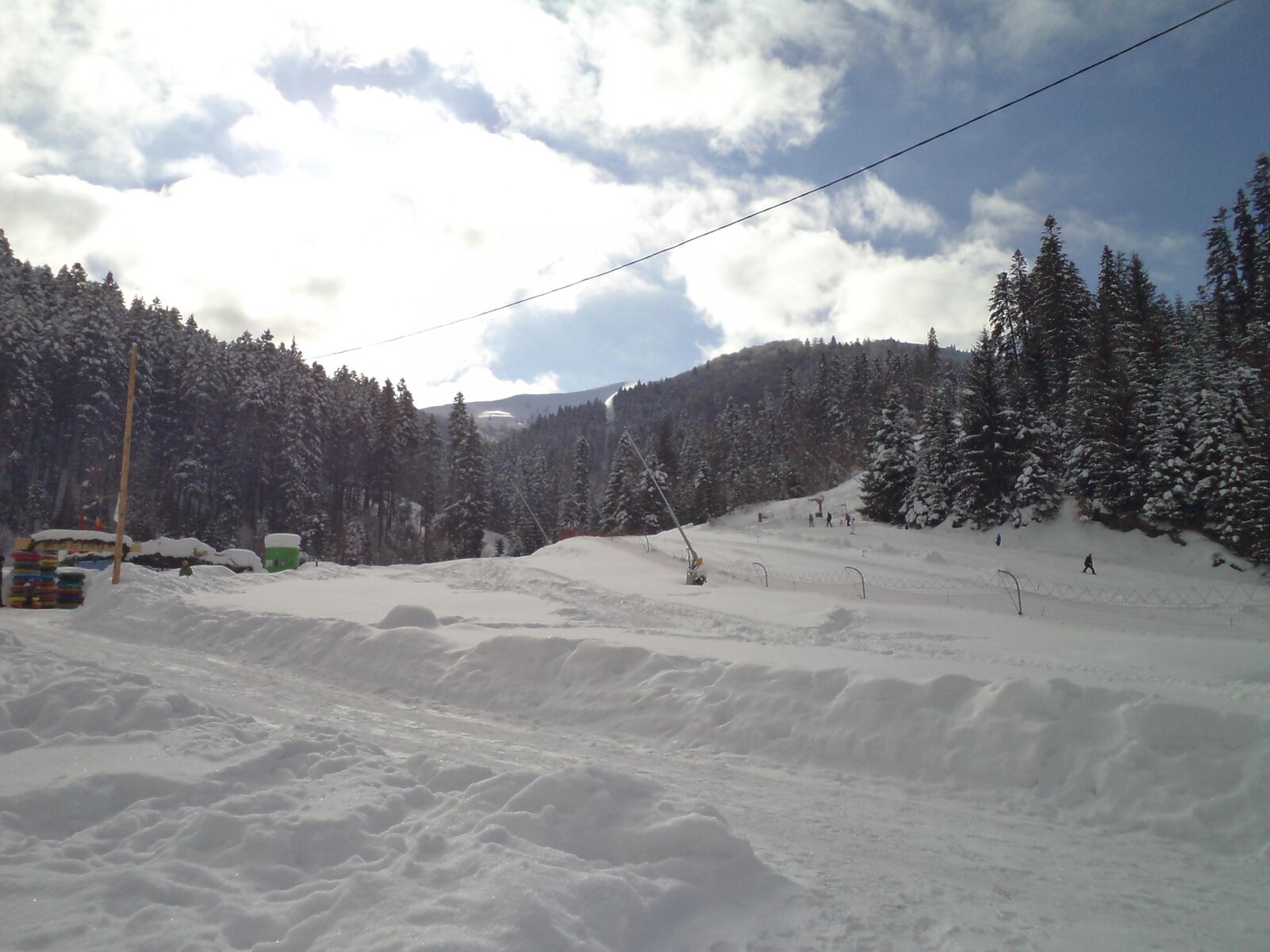
This was Azuga last, or maybe the winter before, but it's only about half a meter, nothing out of the ordinary, just that it stays all winter long! :dance:
DSC00516.jpg

As a matter of interest, the railway that runs up the Prahova valley on the way to Brasov, passes through Predeal which is the highest point on the whole of the Romanian railway system, I think it's 1,200 meters above sea level. Also the climb from Campina (a bit south of us) to Predeal, is the steepest gradient in the country. One of my clients completed reconstruction of that stretch in November 2011 so the gradients have been optimized somewhat to make it more efficient.

The loco in the u-lube movie was struggling a bit :lol: It must have been about 2m deep there (wherever it was). Not on my stretch for sure, maybe up north near Sucava or Moldova, they get it more severe than us with -35C not uncommon.
 
Last edited:
In regards to Nav stuff - I have OZI loaded (legal copy) - but no maps for this Romania 2015 trip and unsure if there are any detailed 1:200 or 1:500 maps available - The Russian maps might cover the area... and show the tracks but they are probably out of date. A mix of the the more modern road maps and the Russian ones are always a good mix.

This Friday - just off to Morocco (again) for transit to Western Sahara..... will have a look around after I get back in December and see what I can find to down load. Even if not used they might be useful etc. Depends really on how 'wild' 'off road' is being planned - if major remote stuff is being planned they will be needed.. else we can just wander around till we find a 'pub' or someone to ask ...
 
I have a load of old topographic maps for whole of Romania in Ozi format
"found" them on the web a couple years ago

two problems
1) the are old
2) they cant easily be merged into a single huge map, because they have borders round the individual maps sheets (scanned from paper copies i assume) so you would have to work with separate map tiles or use photoshop to crop each one to remove the border, then adjust the georef points in Ozi.
i did this for the old morocco maps i have and it took ages, and romania has 100's more tiles!

but ozi does load adjacent map tiles as you drive along, it just makes the planning part harder
 
That'll do - I tend to have large country coverage OZI maps from major suppliers - all OZI Geo ref'd already - the Russian maps are as you say Tiled but also Geo-ref'd - and I plot on the large map and then swap bewteen the detailed scale maps when travelling off road and on the go - taking waypoints as I go along on the detialed maps so at least I know that from the large scale map I'm going the correct direction... and the detailed map show me if I'm just about to go the edge of something nasty... hey it works for me.... and if all else fails - stop at the nearest PUB....
 
Back
Top