Don't like the adverts?  Click here to remove them

morocco

SpinDrift

Well-Known Member
Supporter
Joined
Mar 18, 2010
Messages
1,189
Garage
At the end of January I went to Morocco and Western Sahara for a month. This is my second visit to Mor.

Firstly some figures and stats that might be of use to anyone heading that way:

Ferry crossings were with Brittany Ferries - Portsmouth to Santander - £604 return (purchased 4 weeks before) and with Acciona from Algerciras to Cueta - €180 open return plus a cake and a bottle of bubbly from Viajes Normandie!

In the round trip ex Santander I covered 7458 km with a total cost of £801 for 1079 litres (or 237 gallons) of diesel with an average of 19.5 mpg

The breakdown of the distance covered is:

2278 km were in Spain (there and back) at a total cost of £400 in diesel - cost of diesel was €1.35 per litre
5180 km were in Morocco and Western Sahara at a total cost of £400 diesel (incredibly what it cost me to get from Santander to Algeciras and back!!!) - cost of diesel was 7.4 dirham (£0.57) per litre in Morocco and 5.2 dirham (£0.43) per litre in Western Sahara.

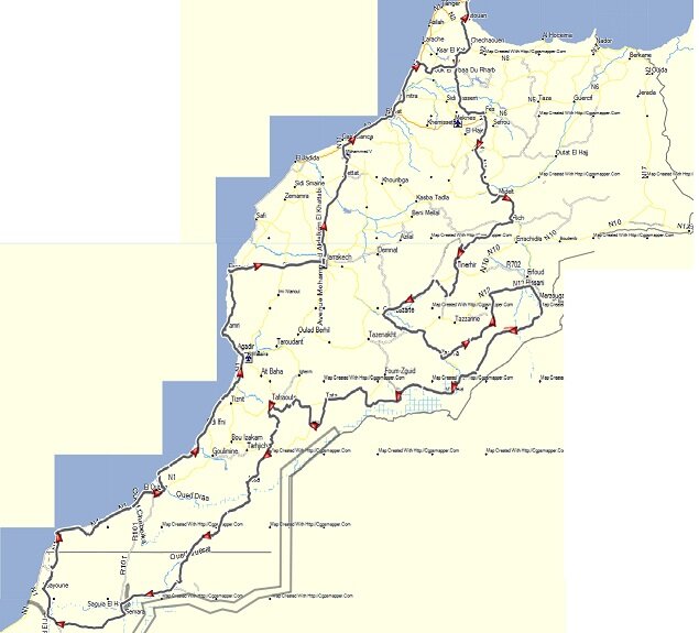
The Morocco part of the route:

[attachment=0:1hswy8wd]map1.jpg[/attachment:1hswy8wd]

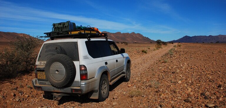
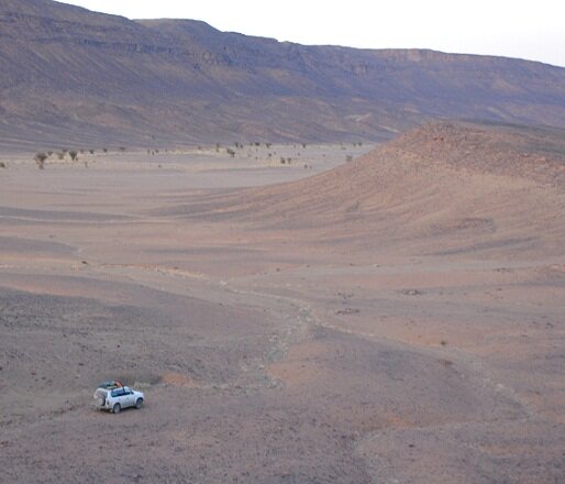
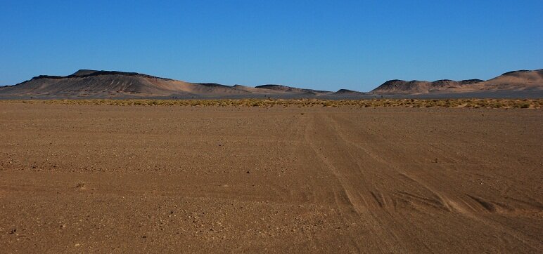
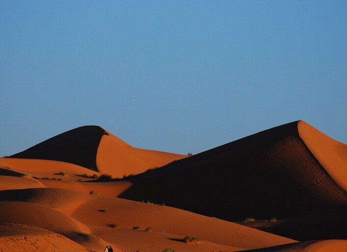
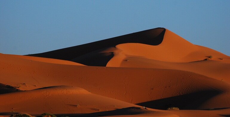
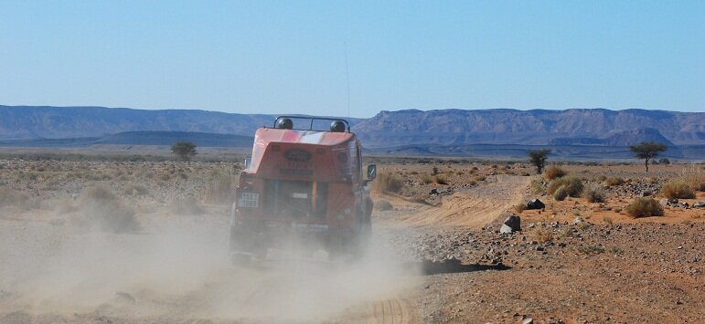
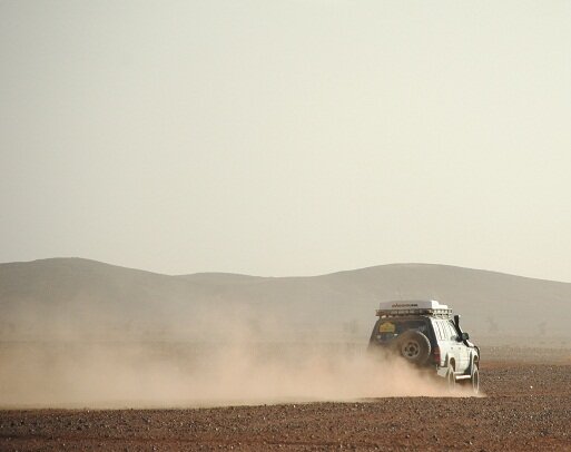
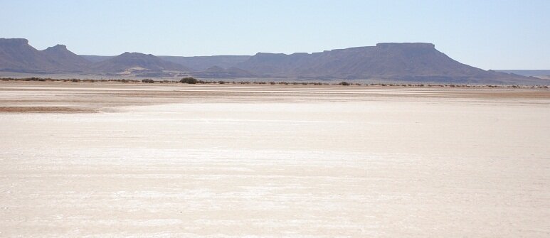
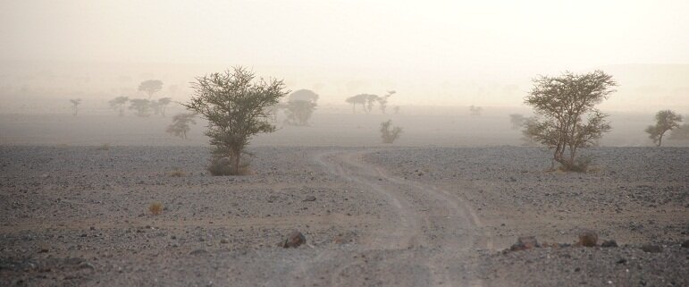
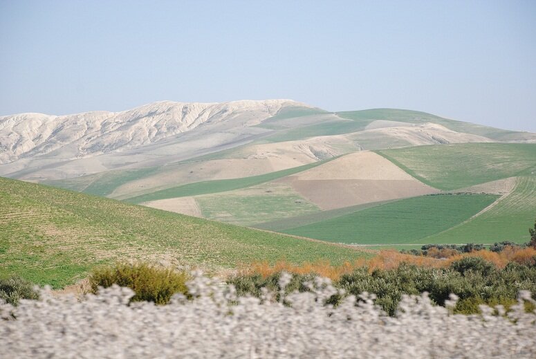
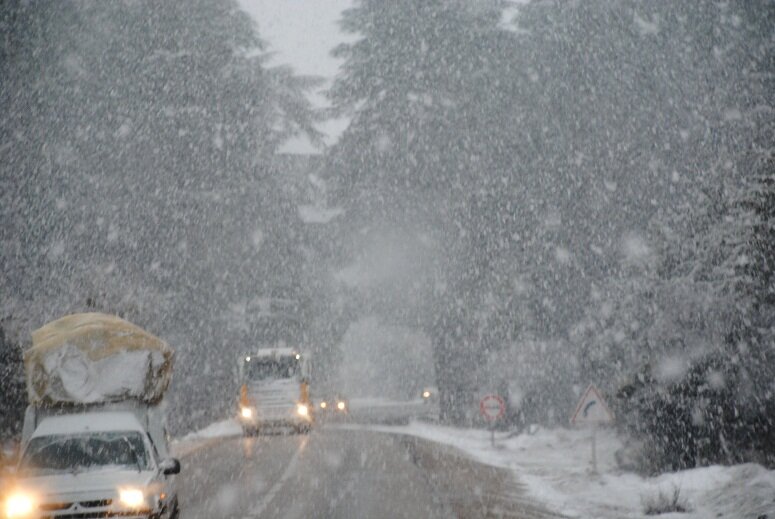
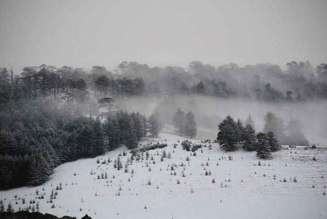
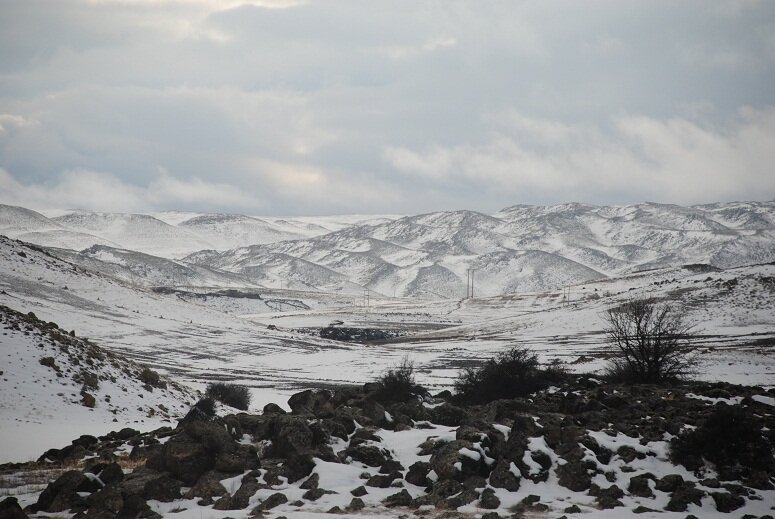
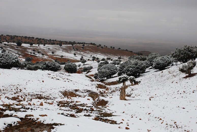
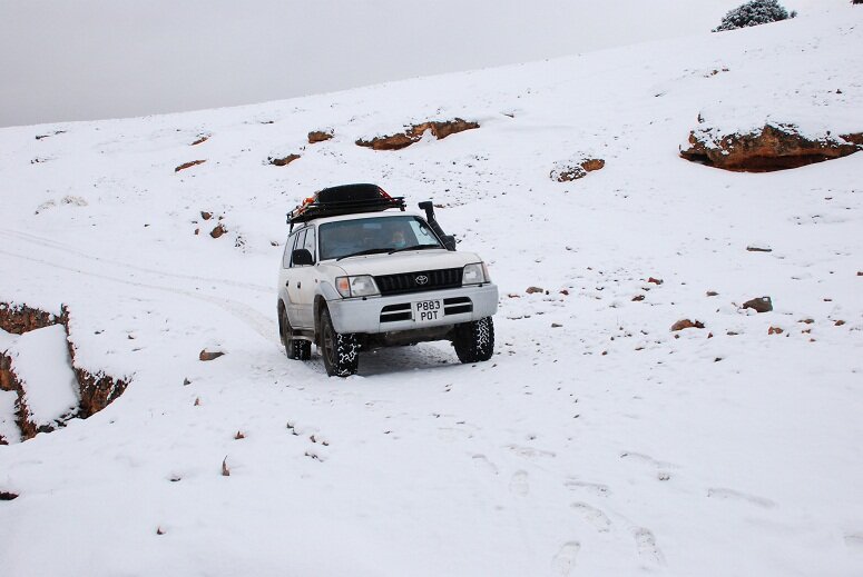
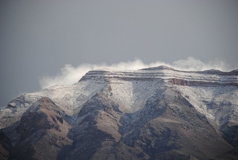
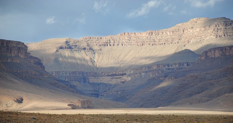
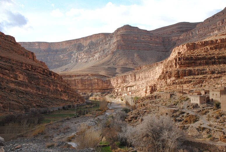
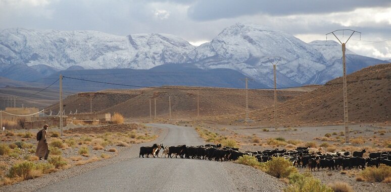
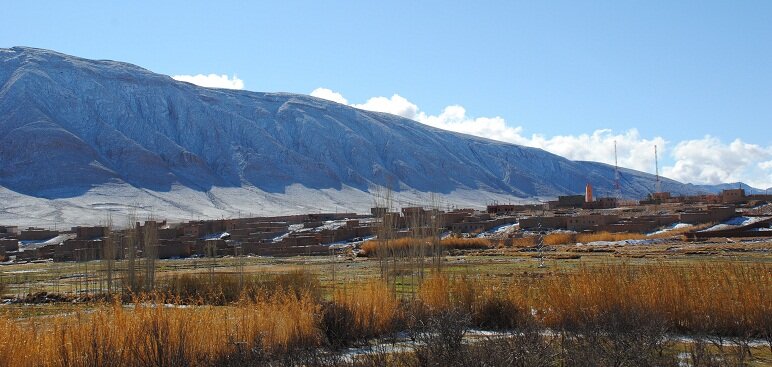
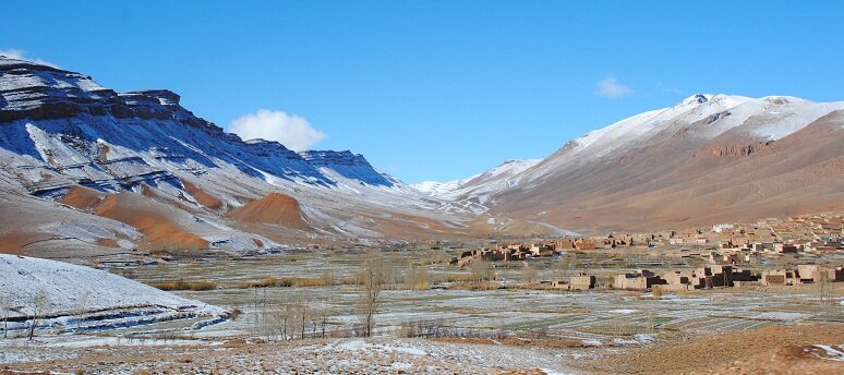
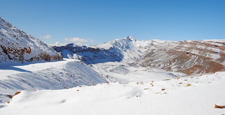
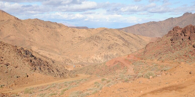
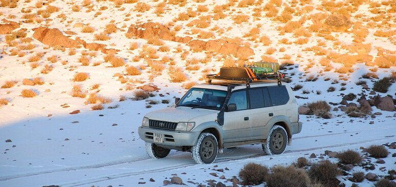
I was in Morocco between 24th January and 17th February. For the most part the temperature in Mor and WS was between 5C and 18C, although it did drop to -5C in the mountains and did occassionally rise to 22C on the desert floor. There was snow in the mountains and I had to drive through a snow storm in the hills between Azrou and Mildelt. I also encountered a few mild sand storms in the desert.

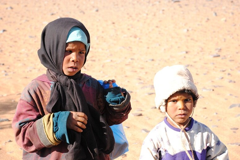
Camping was split approx 50% campsite and 50% wild camp in Mor and WS. For the most part camp sites cost less than £10 a night for 1 vehicle and two people. I also slept in Spanish car parks three times parked alongside some motor homes on the way back.

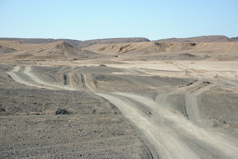
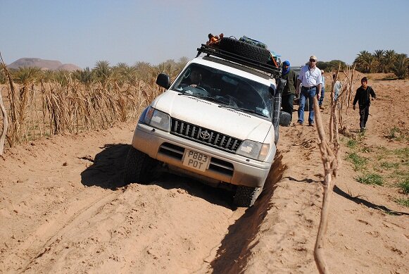
Number of times stuck: twice in sand, both times uneccessarily - first time driving off piste to do some sight seeing and the second time looking for a better camping spot in the dunes above a beach. Both recoveries involved a combination of lowering the tire pressure, digging and using waffle boards.

Assistance given: helped recover a fully kitted Swiss Jeep towing a trailer stuck in some small dunes. For some reason the owner had been trying rahther unsucessfully to recover himself with the trailer still attached. Also when out in the desert, pointed a group of three Swiss and German trucks (3T, 7T and 14T) in the right direction.

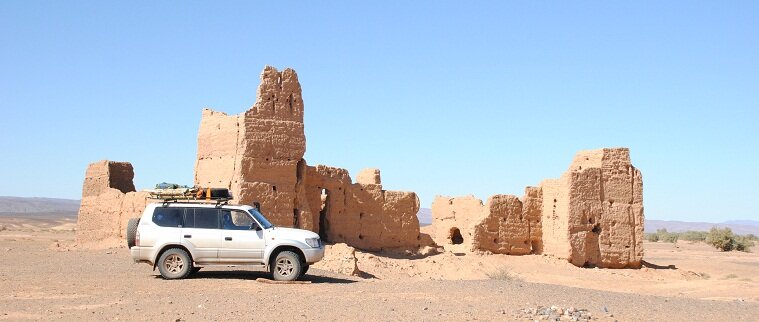
Damage and breakdowns: Nil - except for the ground connector breaking off the cyrix, probably the result of the cable dropping out of place and getting snagged in my big boot (Cyrix is located in the space above the brake pedal). On return the car was MOTed without problem following a standard service :cool:

Pics to follows.
 

Attachments

  • map1.jpg
    map1.jpg
    90.4 KB · Views: 600
Looking forward to seeing your photos.

Looks like you went through the fesh fesh near Remlia just South West of Merzouga, how did you get on with that bit :o

Also, I would be interested in seeing your track through M'Hamid as we are passing thought there next month.
 
Hello there i am thinking to do simler this time next year did you go on arranged route with a company or off your own back.

any advice would be great.

thanks steve.
 
Bat21 said:
Looking forward to seeing your photos.

Looks like you went through the fesh fesh near Remlia just South West of Merzouga, how did you get on with that bit :o

Also, I would be interested in seeing your track through M'Hamid as we are passing thought there next month.

Hi Paul

fesh fesh was great fun actually. My tyre pressure was 12 psi and I had no trouble getting through - you need to try not to lose momentun as the tyres will get dug into the sand.

There is a bit in Remlia that you need to watch out for - you get hemmed in on the track leaving the Remlia with fields and palisades on either sides. The track is badly eorded with a side slope of around 20degrees - which is a little unnerving when you have 80kg+ on the roof. I went for it and it was actually fine. We were followed onto this part of the track by some other vehicles that reversed out. Not sure how they got through.

I didnt waypoint the spot but it is approx N30 41 08 W4 25 08
 

Attachments

  • remlia.jpg
    remlia.jpg
    188.8 KB · Views: 560
  • DSC_2574.JPG
    DSC_2574.JPG
    149.1 KB · Views: 545
Mr T said:
Hello there i am thinking to do simler this time next year did you go on arranged route with a company or off your own back.

any advice would be great.

thanks steve.

Hi Steve

This is my second time in Morocco. Both times I travelled on my own. There are a few books with information about pistes, comlete with waypoints that you can plug into a gps. This time I used Chris Scott's Morocco Overland. Look here http://www.morocco-overland.com/ for info. Last time I used Sahara Overland by the same. There is also a series of books by Gandini and it is possible to find info and waypoints on the internet.
 
The first three days of the trip were spent getting to Fez. We drove from Santander to Malaga, wehre we stayed with a friend, in 11 hours. We then crossed over to Cueta and on into Morocco stopping in Chefchouan for the first night in Morocco. Then on to Fez, where we stayed at Diamant Vert campsite. Camping, I should explain, involved sleeping in the back of the LC which was modified to provide storage space and a sleeping platform.
 

Attachments

  • DSC_0348.JPG
    DSC_0348.JPG
    183.9 KB · Views: 525
  • DSC_0198.JPG
    DSC_0198.JPG
    164.3 KB · Views: 534
Don't like the adverts?  Click here to remove them
Re: morocco - mountains and snow

From there we headed on to Midelt via Azrou. The layout, architecture and cleanliness of Azrou is similar to a village in the Swiss Alps.

[attachment=9:12yddzsd]DSC_0481.JPG[/attachment:12yddzsd]

As we entered the Foret de Cedar we were hit by a snow blizzard and didnt get to see any apes.

[attachment=8:12yddzsd]DSC_0503.JPG[/attachment:12yddzsd]

In Midelt we overnighted in a hotel and headed out onto the piste to Imilchil the following morning, wi the intension of continuing on to Agoudal and Oued Dades. A distance of 279km along piste through the Atlas mountains. As it tunred out we encounted snow and ice and as we were travelling alone, decided, given the remoteness of the region and the conditions, to tun back and continue across the mountains on asphalt.

[attachment=7:12yddzsd]DSC_0525.JPG[/attachment:12yddzsd]
[attachment=6:12yddzsd]DSC_0544.JPG[/attachment:12yddzsd]
[attachment=5:12yddzsd]DSC_0687.JPG[/attachment:12yddzsd]
[attachment=4:12yddzsd]DSC_0689.JPG[/attachment:12yddzsd]

So back in Midelt we headed towards Rich to pick up the road to Ait Hani above the Todra Gorge via Amallego and Aszul. Along the way we passed through some small villages set in scenic fertile valleys.

[attachment=3:12yddzsd]DSC_0933.JPG[/attachment:12yddzsd]
[attachment=2:12yddzsd]DSC_0987.JPG[/attachment:12yddzsd]
[attachment=1:12yddzsd]DSC_1051.JPG[/attachment:12yddzsd]
[attachment=0:12yddzsd]DSC_1108.JPG[/attachment:12yddzsd]
 

Attachments

  • DSC_0481.JPG
    DSC_0481.JPG
    124.8 KB · Views: 520
  • DSC_0503.JPG
    DSC_0503.JPG
    160.2 KB · Views: 519
  • DSC_0525.JPG
    DSC_0525.JPG
    121.5 KB · Views: 514
  • DSC_0544.JPG
    DSC_0544.JPG
    181 KB · Views: 524
  • DSC_0687.JPG
    DSC_0687.JPG
    218.6 KB · Views: 508
  • DSC_0689.JPG
    DSC_0689.JPG
    131.1 KB · Views: 529
  • DSC_0933.JPG
    DSC_0933.JPG
    153.1 KB · Views: 511
  • DSC_0987.JPG
    DSC_0987.JPG
    154.7 KB · Views: 509
  • DSC_1051.JPG
    DSC_1051.JPG
    228.5 KB · Views: 514
  • DSC_1108.JPG
    DSC_1108.JPG
    160.8 KB · Views: 522
The plan now was to head up to Agoudal along the new tarmac road to join with the piste we had aborted and head down into Oued Dades. In the end we turned back again! The upper reached of the road to Agoudal was covered in snow and we decided to turn back as the piste would not be drivable in such conditions.

[attachment=6:1eqjq3ar]DSC_1309.JPG[/attachment:1eqjq3ar]
[attachment=5:1eqjq3ar]DSC_1323.JPG[/attachment:1eqjq3ar]
[attachment=4:1eqjq3ar]DSC_1339.JPG[/attachment:1eqjq3ar]


So we headed out through Todra Gorge and on to Tinehrir to pick up the piste that headed SW towards the Sarho Mountains, Tizi N Tazazert (Tizi being pass) and on to Nekob.

[attachment=3:1eqjq3ar]DSC_1491.JPG[/attachment:1eqjq3ar]
[attachment=2:1eqjq3ar]DSC_1496.JPG[/attachment:1eqjq3ar]

Did someone say mountains and pass? Yes, well, once we were back into the mountians we quickly encountered snow again. We got to within a few hundred metres of the pass when we stopped.

[attachment=1:1eqjq3ar]DSC_1532.JPG[/attachment:1eqjq3ar]

One recce later and once again we decided to turn back. The decent ( I had been here before) was along a narrow snow covered track with sheer drops and several switch backs. Not something to comfortably do in icey conditons. That night we wild camped in the mountains. The night sky was spectacular. Overnight the temperature dropped to -5C and we had ice on the inside of the windows! Beautiful views though:

[attachment=0:1eqjq3ar]DSC_1576.JPG[/attachment:1eqjq3ar]

It was time to head for warmer climes.
 

Attachments

  • DSC_1309.JPG
    DSC_1309.JPG
    152.5 KB · Views: 509
  • DSC_1323.JPG
    DSC_1323.JPG
    155.1 KB · Views: 510
  • DSC_1339.JPG
    DSC_1339.JPG
    138.6 KB · Views: 527
  • DSC_1491.JPG
    DSC_1491.JPG
    172.3 KB · Views: 510
  • DSC_1496.JPG
    DSC_1496.JPG
    161.3 KB · Views: 514
  • DSC_1532.JPG
    DSC_1532.JPG
    193.7 KB · Views: 524
  • DSC_1576.JPG
    DSC_1576.JPG
    109.2 KB · Views: 517
excellent read so far Reinhard
good to see the 90 series in action in the Atlas mountains - the scenery looks stunning
 
Thanks. Yes, the scenery is quite stunning both in the mountains and in the desert.
 
Great pictures.
Snow in Morocco isn't most peoples thoughts.
It's quite a change from the general sand dunes.

Gra.
 
Great report and some really super pics. :thumbup: :clap:

Don't always associate that part of the world with snow covered, wintry mountain passes.....
 
Thanks. Yes it is different from the normal impression of Morocco. The pistes in the mountains can be pretty desolate and it would be fool hardy to tackle them without the backup of a second vehicle. The risk of accident are higher in icey conditions . And I have had a bad experience is such conditions - having blown the front diff and transfer box last year. Even if I had a sat phone, who would I have called for assistance in the event of an accident or breakdown? There were days in the desert when we were luck if we saw another vehicle. If we had a breakdown there, we could have sat it out - we had enough food and water to last a few weeks if we had to - but temperatures of -5C in snow and ice are something else.
 
When I went to Morocco and was up in the Atlas Mountains we never had to drive while it was actually snowing but we came across a small avalanche that had blocked the piste, :think: there were 5 blokes and 2 females so we got the shovels out and dug through, took us about 1 1/2 hrs or so as only two of the others had shovels :roll: I never expected to see snow in Morocco though. :shock:
 
Into the desert

We left the Sarho Mountains via Boulmina Dades and Orzazate, heading for Zagora ... on tarmac - so far we haven't had much luck on the pistes. The road took us through cultivatesd and baren areas, and villages and palmeries.

We camped at Le Jairdan de Zagora where we met a two Dutch guys who were travelling in a converted 4x4 VW van - seems that it is possible to reduce the amount of road tax in the NL if a truck or van is converted into a camper van. Any way these two guys had successfully traversed the Midelt - Imilchil - Oued Dades piste the week before - there wasnt any snow on the piste then.

From Zagora we picked up a piste headed NE towards Timerzif. The first part of the piste was very stoney and bumpy. At one point we spotted the skeleton of a camel (the first of a number of skeletons we would see during the trip) at the side of the piste. Shortly after we came across a desert well. This was more like it :)

[attachment=9:1vukeyt6]DSC_1928.JPG[/attachment:1vukeyt6]
[attachment=8:1vukeyt6]DSC_1950.JPG[/attachment:1vukeyt6]

As we climbed into up to Tizi n Tafilalet between Jbel Rhart and Jbel Tadrart we came across some road building, which was to run parallel to the piste for a few kilometers. It weems that this new road will connect Zagora to Tazzarine and is shown as the N12 on the Michelin map. We continued east where the new road branched north and eventually found a spot to wild camp in a small valley about .5 km from the piste. Brilliant. This is what the trip is all about.

[attachment=7:1vukeyt6]DSC_2014.JPG[/attachment:1vukeyt6]

The next day we continued along the piste towards Timerzif. We drove along open plains with scattered hills and passed close to small villages. In the distance we could see sand piled up against the sides of some of the hills. We came across groups of abandoned buildings that were being reclaimed by the desert.

[attachment=6:1vukeyt6]DSC_2131.JPG[/attachment:1vukeyt6]
[attachment=5:1vukeyt6]DSC_2145.JPG[/attachment:1vukeyt6]

We continued along the way. The landscape remained the same: wide open plains with scattered hills and plateaus (similar to what you see in Westerns - we were expecting Clint Eastwood to ride up to us). The ground varied from hard packed earth, to stoney to sandy and even to fech fech. In places there were patched of small white flowers indicating recent rains - but the ground was dry. Occassionally we would see one or more camels grazing on clumps of dry grass.

At one point we came across the ruins of Tamgannt Kasbah (citadel) around 6km before Fezzou.

[attachment=4:1vukeyt6]DSC_2211.JPG[/attachment:1vukeyt6]

We continued north till we reached the N12.

[attachment=3:1vukeyt6]DSC_2287.JPG[/attachment:1vukeyt6]
[attachment=2:1vukeyt6]DSC_2290.JPG[/attachment:1vukeyt6]

Then we headed towards Rissani and then on towards the dunes in Merzouga. After a photo stop in the dunes we carried on south and wild camped south of Taouz just off our next piste. It turned out that the rocks around our camping spot were filled with fossils.

[attachment=1:1vukeyt6]DSC_2381.JPG[/attachment:1vukeyt6]
[attachment=0:1vukeyt6]DSC_2382.JPG[/attachment:1vukeyt6]
 

Attachments

  • DSC_1928.JPG
    DSC_1928.JPG
    166.1 KB · Views: 220
  • DSC_1950.JPG
    DSC_1950.JPG
    117.8 KB · Views: 208
  • DSC_2014.JPG
    DSC_2014.JPG
    97.9 KB · Views: 217
  • DSC_2131.JPG
    DSC_2131.JPG
    130.4 KB · Views: 217
  • DSC_2145.JPG
    DSC_2145.JPG
    131.9 KB · Views: 215
  • DSC_2211.JPG
    DSC_2211.JPG
    108.5 KB · Views: 229
  • DSC_2287.JPG
    DSC_2287.JPG
    114.8 KB · Views: 231
  • DSC_2290.JPG
    DSC_2290.JPG
    113.3 KB · Views: 212
  • DSC_2381.JPG
    DSC_2381.JPG
    98.5 KB · Views: 216
  • DSC_2382.JPG
    DSC_2382.JPG
    91.5 KB · Views: 214
Next morning we headed south west onto what is considered to be a classic - the Merzouga to Mhamid piste which skirts the Algerian border for a distance of some 220 km. Three years ago I had done this piste in the reverse direction and it was great. For the first few kilometres the piste follows a number of oueds (valleys) that, following rain in the hills, can be water logged. As we picked our way along the oued beds we were over taken by a number of motor bikes and shortly after by a couple of racing vehicles - we had found ourselves in the middle of a rally heading for Senegal and would be in their company for the rest of the day. The rally were accompanied by a support truck, complete with recovery trailer, and had an LC as a run around support vehicle. It was amusing when one one of these heavily supported drivers would later ask 'So you are holiday? out here? on your own?' ... 'erhm, yes'

[attachment=9:qx3nmb7j]DSC_2432.JPG[/attachment:qx3nmb7j]
[attachment=8:qx3nmb7j]DSC_2486.JPG[/attachment:qx3nmb7j]
[attachment=7:qx3nmb7j]DSC_2488.JPG[/attachment:qx3nmb7j]

We made our way in the direction of Remlia, passing a few bedouine tents and goat herders and some auberges along the way. Remlia is the first village you come across on this piste. As with most remote villages in Morocco, children come running out asking for 'bon bon' and 'stilo'. We passed through the village and the piste passed through a narrow section between some cultivated fields. The track was badly rutted, was full of fine powdery dust and had a side slope of some 20 degrees. I was not very keen on this with the load I was carrying on the roof rack made. But with rally cars pulling up behind the only way was forward. It was a butt clenching experience. And whereas I was hesitant in tacking this part of the piste, the rally boys reversed out the way they came. I'm not sure which way they eventually took, nut we didnt see them for another three hours.

[attachment=6:qx3nmb7j]DSC_2488a.JPG[/attachment:qx3nmb7j]
[attachment=5:qx3nmb7j]DSC_2488b.JPG[/attachment:qx3nmb7j]
[attachment=4:qx3nmb7j]DSC_2488c.JPG[/attachment:qx3nmb7j]

Past the village, the piste passed through some low dunes and the dreaded fech fech. Actually the fech fech was no problem at all. We continued along on flat ground dotted tufts of vegitation. Hills rose up about a kilometer away on either side of the piste. Eventually we broke out on a wide open plain, passing the village of Tafraoute and out onto the dried lake bed of Lac Maider. The landscape was flat with the occassional hill in the distance. The lake bed itself made for fast driving but was a mix of dried out mud flat, sometimes littered with small stones, sometimes with hard ruts, sometimes patches of sand and corrugations. And still there were occassional tufts of grass and goats,

[attachment=3:qx3nmb7j]DSC_2560.JPG[/attachment:qx3nmb7j]

And the wierdest thing is that you would stop were you were sure that there was no one around and suddenly you would see some one running towards you.

[attachment=2:qx3nmb7j]DSC_2704.JPG[/attachment:qx3nmb7j]

Soon a sand or rather dust storm started to blow up.

[attachment=1:qx3nmb7j]DSC_2773.JPG[/attachment:qx3nmb7j]

We passed the army checkpoint and took shelter for the night in Campsite Miguide 4x4. At this point we were very close to the border with Algeria - hence the checkpoint. If you had to follow the piste south from the checkpoint you would get to within 5kms of the border. That evening while I was chatting with the campsite owner in a mix of broken Arabic and French, I asked him about the radio antenna on the roof of his house - it is for contacting the border police if tourists get to close to the border is what I was told!

[attachment=0:qx3nmb7j]DSC_2779.JPG[/attachment:qx3nmb7j]
 

Attachments

  • DSC_2432.JPG
    DSC_2432.JPG
    194.4 KB · Views: 212
  • DSC_2486.JPG
    DSC_2486.JPG
    109.3 KB · Views: 209
  • DSC_2488.JPG
    DSC_2488.JPG
    115.7 KB · Views: 212
  • DSC_2488a.JPG
    DSC_2488a.JPG
    120.1 KB · Views: 213
  • DSC_2488b.JPG
    DSC_2488b.JPG
    101.8 KB · Views: 217
  • DSC_2488c.JPG
    DSC_2488c.JPG
    68.9 KB · Views: 209
  • DSC_2560.JPG
    DSC_2560.JPG
    93.2 KB · Views: 211
  • DSC_2704.JPG
    DSC_2704.JPG
    170.6 KB · Views: 215
  • DSC_2773.JPG
    DSC_2773.JPG
    105.9 KB · Views: 207
  • DSC_2779.JPG
    DSC_2779.JPG
    81.4 KB · Views: 212
Really enjoying your write up so far Rein - keep it coming :cool:
 
I also am very happy to read about your trip, along with teh ever great photos.

Keep on coming, don't stop now.

Gra.
 
Back
Top